
Easily Determine Latitude and Longitude on a Map
Latitude and longitude are crucial parameters for establishing a location on the planet. Learning to find these coordinates on a paper map can be useful in various situations. While modern online maps allow you to do this with just a click, knowing how to determine coordinates manually on a physical map is also valuable. Start by understanding the basics, then move on to practice.
Understanding Latitude and Longitude
Step 1. Grasp the Concept of Latitude.
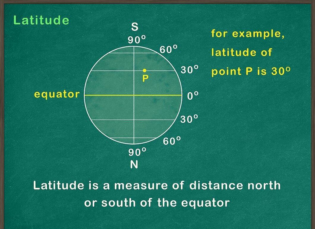
Understand what latitude is. It measures the distance north or south of the equator—a fictional line that divides the Earth into two equal halves. The Earth is divided into 180 lines of latitude, located on either side of the equator, known as parallels. All parallels run parallel to the equator and are represented horizontally on a map. There are 90 parallels north of the equator and 90 south.
Step 2. Learn What Longitude Is.
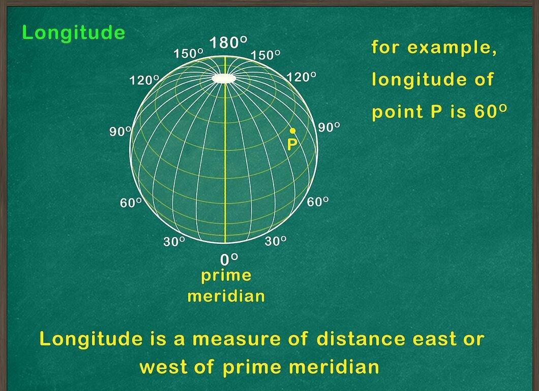
Study the definition of longitude. Longitude measures the distance east or west of the prime meridian, which runs from the North Pole to the South Pole. Lines of longitude, known as meridians, run vertically on maps. Noon occurs at the same time for all points on the same meridian. There are a total of 360 meridians on Earth: 180 east and 180 west of the prime meridian.
- The meridian opposite the prime meridian is called the antimeridian.
Step 3. Learn the Units of Measurement for Latitude and Longitude.
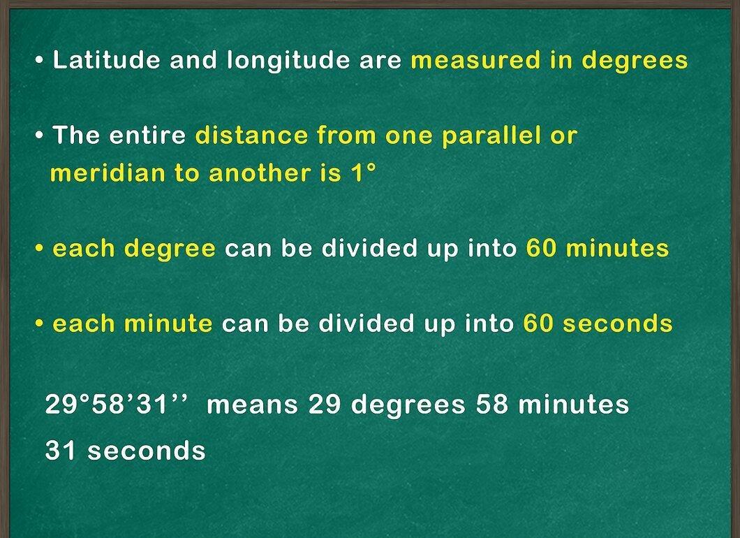
Understand how latitude and longitude are measured. They are typically expressed in degrees (°), minutes (′), and seconds (″). The total distance between neighboring parallels or meridians is 1°. For more precise measurements, each degree is divided into 60 minutes, and each minute into 60 seconds (which totals 3600 seconds in one degree).
- Latitude and longitude are expressed in degrees rather than kilometers, as the Earth is shaped like a sphere. The distance between degrees of latitude is always the same (60 nautical miles or 111.12 km), whereas the distance between degrees of longitude decreases as one approaches the poles.
Step 4. Determine Coordinates Relative to the Zero Point.
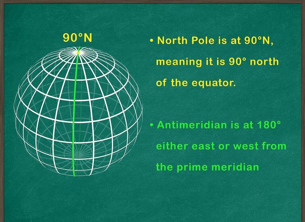
To measure latitude, use the equator as the starting line, where latitude equals 0°. For measuring longitude, the starting line is the prime meridian with a longitude of 0°. Coordinates express how far a point is from these starting lines and in which direction.
- For example, the latitude of the North Pole is 90° N, meaning it is 90° north of the equator.
- The antimeridian has a longitude of 180°, which can be designated as either west or east longitude.
- The Great Sphinx in Giza, Egypt, is located at 29°58′31″ N and 31°8′15″ E, indicating its position slightly south of 30° N and approximately 31° east of the prime meridian.
How to Find Coordinates on a Map
Step 1. Choose the Right Map.
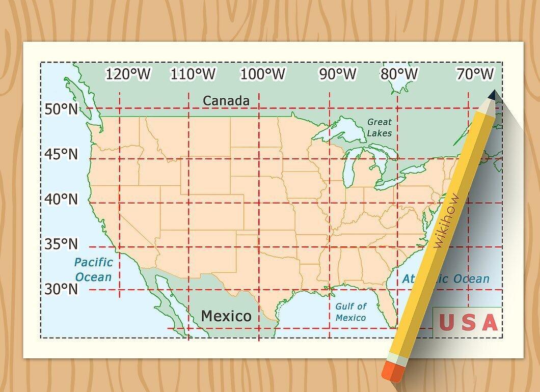
Select a map that marks latitude and longitude lines. Not every map contains this data. They are typically found on maps of larger areas, such as atlases. On maps of smaller areas, such lines may be present on topographic maps that show the terrain in more detail. Note that in Russia, topographic maps at a scale of 1:50,000 and above may be classified.
Step 2. Locate the Area of Interest.
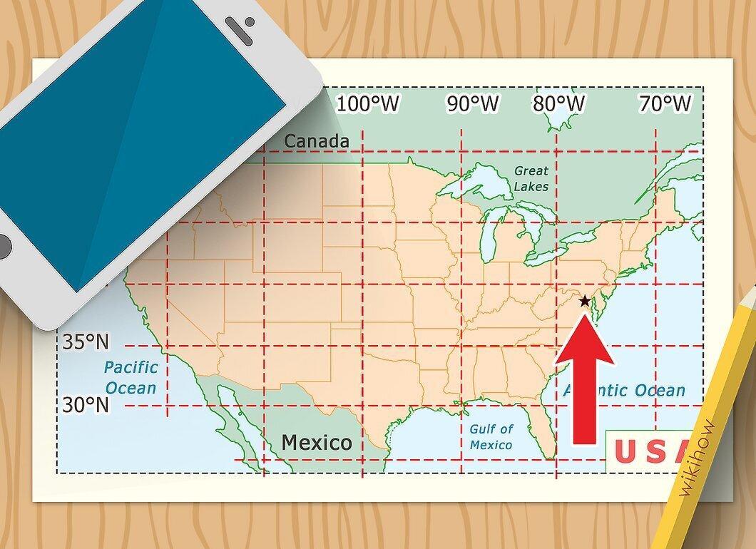
Look at the map and find the point or area for which you want to get the coordinates. Mark the point of interest with a pin or pencil.
Step 3. Identify Latitude and Longitude Markings on the Map.
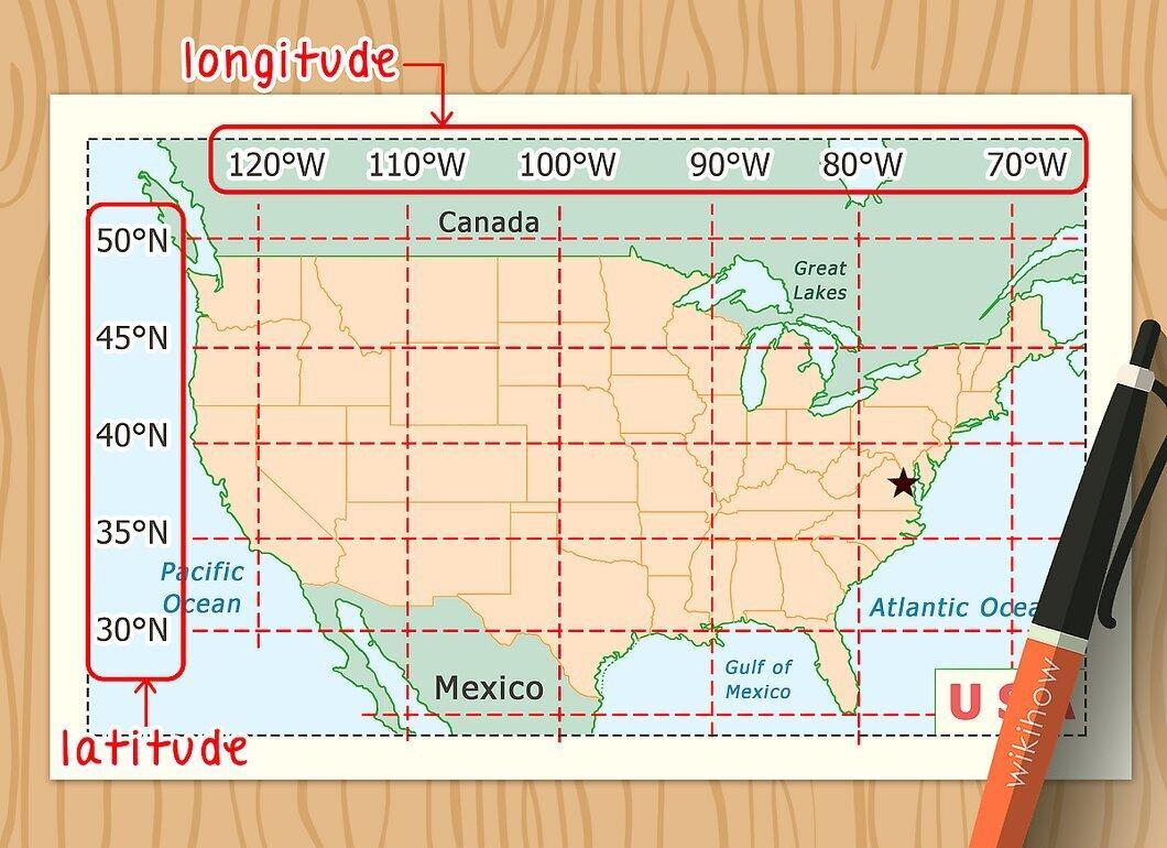
Determine the latitude and longitude lines on your map. Latitude is marked by horizontal lines evenly spaced across the map, while longitude is marked by vertical lines. Pay attention to the numbers along the edges of the map—they denote coordinates for each line.
- Latitudes are displayed along the western and eastern edges of the map, while longitudes are along the southern and northern edges.
- Depending on the map's scale, the numbers may indicate not just whole degrees but also their fractions. For instance, minutes may be shown instead of degrees (e.g., 32°0′, 32°1′, etc.).
- The map should also indicate how latitude and longitude relate to the equator and prime meridian (north or south latitude, east or west longitude).
- Be careful not to confuse latitude and longitude lines with the kilometer grid, which also appears on maps, especially topographic ones. In Russian topographic maps, kilometer lines are marked with two-digit numbers (without the degree symbol) along the perimeter of the map, while latitude and longitude labels are only found in the corners.
Step 4. Use a Ruler to Mark Latitude.
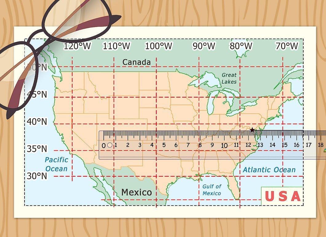
Using a ruler, mark the latitude of your point of interest. Draw a horizontal line from the point to the nearest western or eastern edge of the map, ensuring it is parallel to the nearest latitude line.
Step 5. Draw a Line for Longitude.
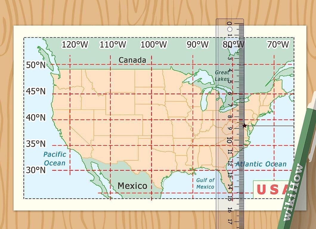
From the same point, draw a vertical line to the top or bottom edge of the map to mark the longitude, keeping it parallel to the nearest longitude line.
Step 6. Determine the Latitude and Longitude of the Point from the Markings.
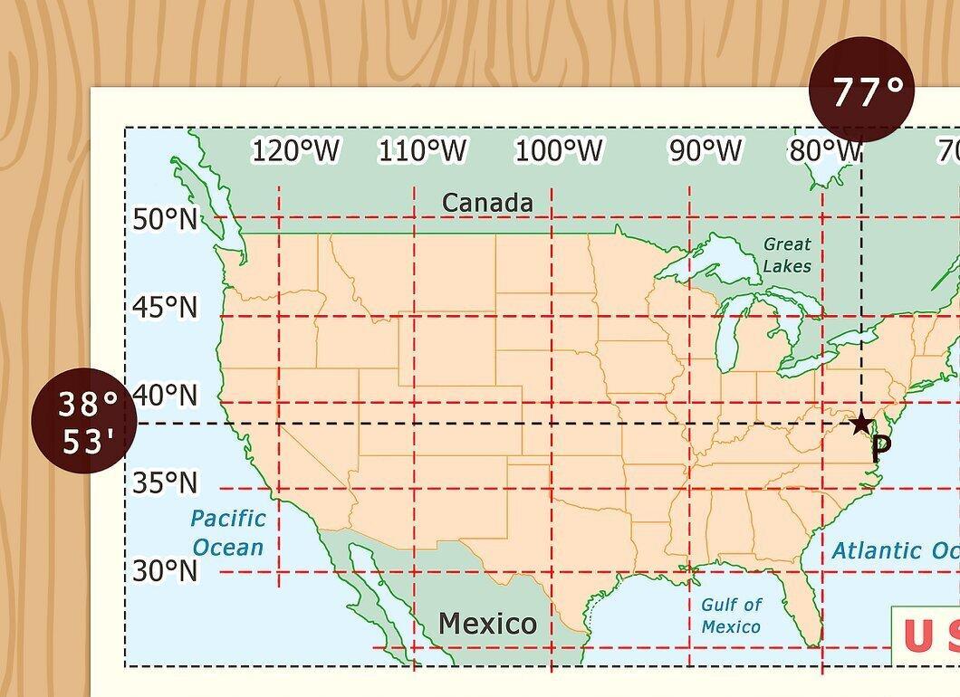
Using the labels, determine the latitude and longitude of your point of interest. Depending on the scale of the map, you may be able to pinpoint the coordinates to degrees, minutes, or seconds. Find the location where your lines intersect and determine the coordinates based on their position relative to the nearest lines on the map.
- If the map shows seconds, find the nearest value of seconds to the intersection of your lines. For example, if the line is 5″ above the 32°20′ N line, the latitude will be approximately 32°20′5″ N.
- If the map lists minutes but not seconds, you can determine latitude or longitude to within 6 seconds by dividing the space between the lines into tenths. If the longitude line is 2/10 to the left of the 120°14′ E line, then its longitude will be approximately 120°14′12″ E.
Step 7. Combine the Data into Coordinates.
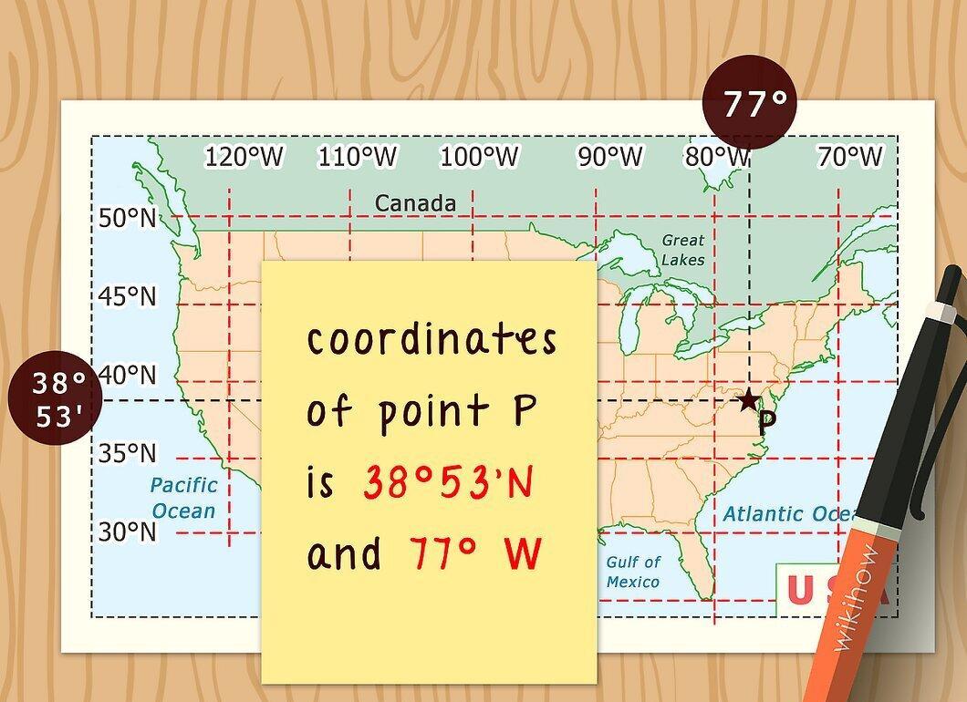
Gather all measurements to obtain the coordinates. Geographic coordinates are the intersection point of latitude and longitude lines. Summarize by combining the obtained values for latitude and longitude, for example, 32°20′5″ N, 120°14′12″ E.