
Latitude and longitude are coordinates that help accurately pinpoint a location on Earth. There are several ways to obtain this information, some of which require special tools. In this article, we will discuss how to easily determine latitude and longitude using the internet, maps, and straightforward methods.
Using the Internet
Step 1. Search online for 'how to find latitude and longitude by address'.
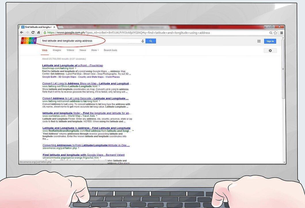
Step 2. Visit one of the websites from the search results and ensure it is suitable for your region. These sites usually have instructions and a field for entering your address, such as:
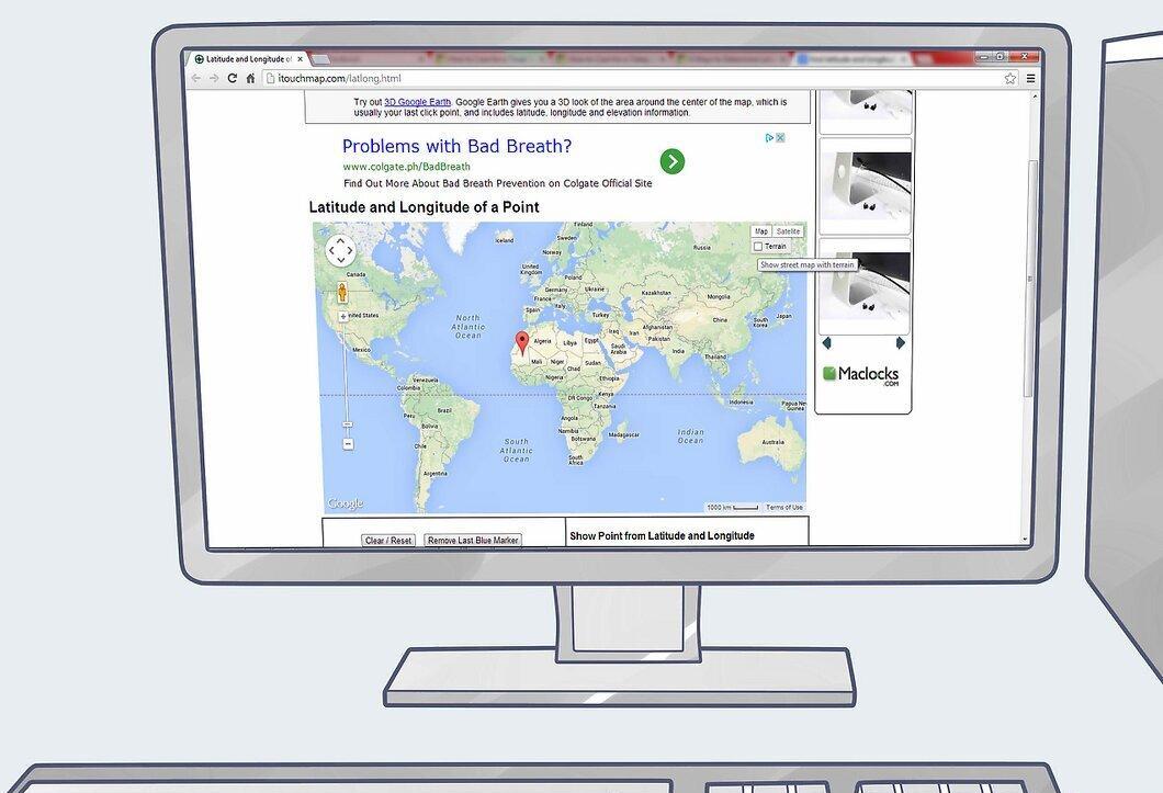
Choose a site that covers your continent, country, and area. You will need to enter details such as country, city, street, house number, and postal code.
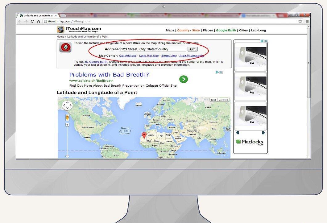
Step 3. Enter your address and wait for the results.
Using Google Maps
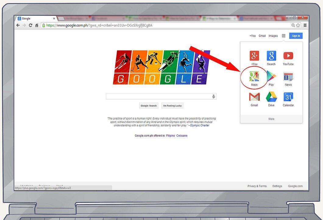
Step 1. Go to google.com and select the 'Maps' section at the top of the page.
Step 2. Enter the address (street, house number, city, postal code) in the search bar and press "Enter".
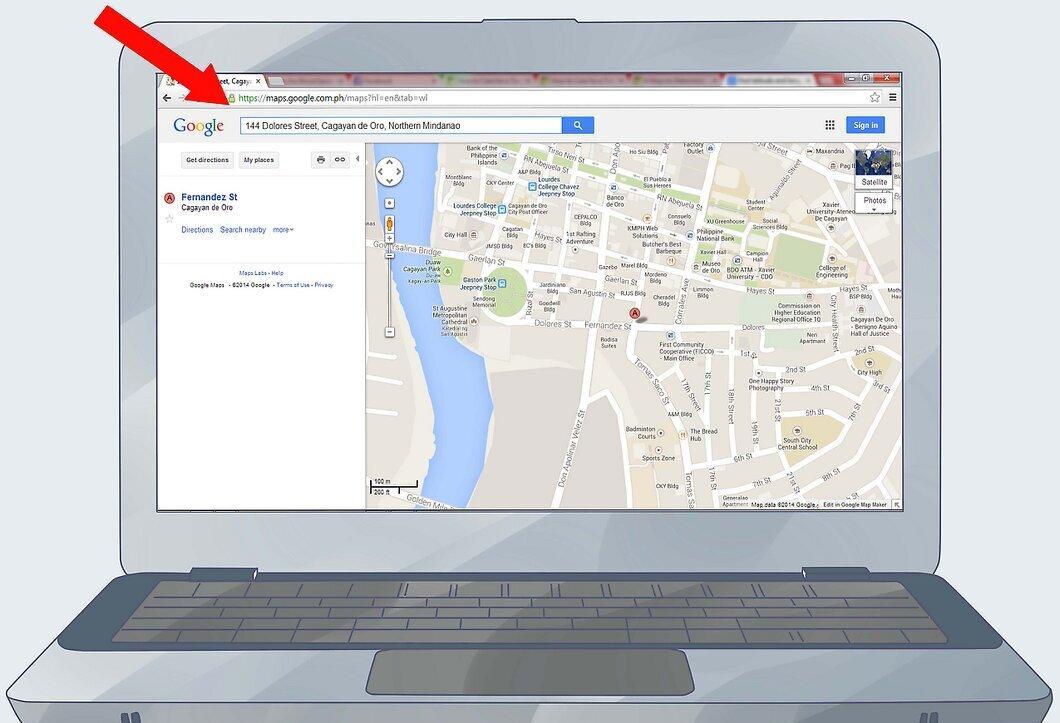
- Make sure the location you entered is in the center of the screen.
- By default, your location will be centered unless you move the map.
Step 3. Copy and paste the following code: javascript:void(prompt(''
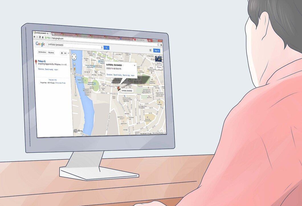
Copy and paste: javascript:void(prompt('',gApplication.getMap().getCenter())) into your browser's address bar. Press "Enter", and a window will appear displaying the latitude and longitude of your location.
- Note: Sometimes the part of the code "javascript:" does not show in the address bar (even if you copied it correctly). To fix this, simply place your cursor at the beginning of the line and type "javascript:" before the text.
- Additional methods for determining coordinates using Google Maps can be found in the article "How to Determine Latitude and Longitude Using Google Maps".
Using a Map
Step 1. Familiarize yourself with the map.
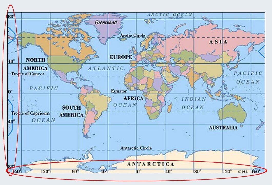
Take a closer look at the map. Usually, small numbers along the vertical and horizontal lines represent the latitude and longitude coordinates.
- Latitude (on maps with north at the top) is indicated along the horizontal lines.
- Longitude is displayed along the vertical lines.
Step 2. Locate your position on the map.
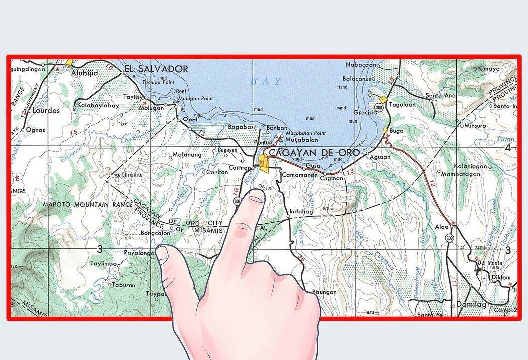
Identify your position on the map. Write down the name of the nearest city or settlement. To learn how to do this, read the article "How to Read a Map".
Step 3. Find the nearest latitude and longitude lines.
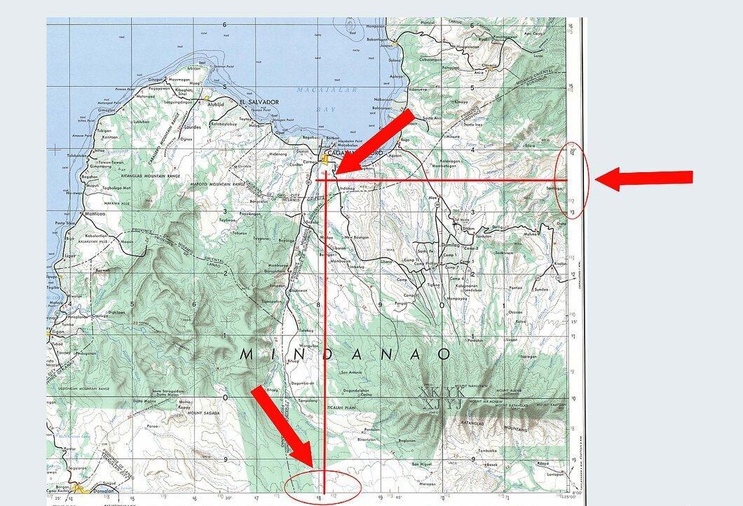
Determine the nearest latitude and longitude lines and note their values.
Step 4. Calculate your coordinates.
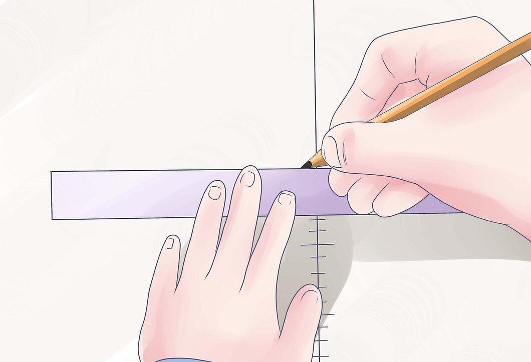
Identify your latitude and longitude. For approximate values, you can estimate the distance from the lines to your position by eye.
- Depending on the scale of the map, the distance between latitude and longitude lines may vary, but is typically 15 degrees. If you need more precise data, use a ruler or measuring tape to divide the intervals.
Determining Latitude and Longitude on Site
Step 1. Use a compass to draw a line on the ground from north to south.
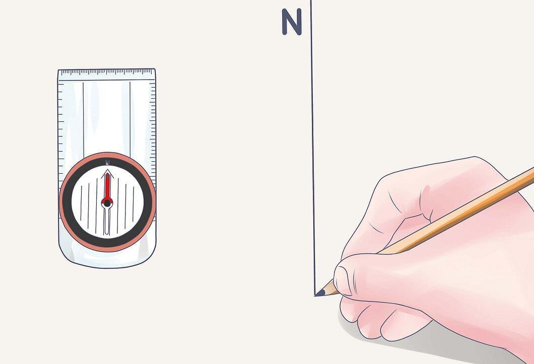
Step 2. Insert a pole vertically at the southernmost point of the line.
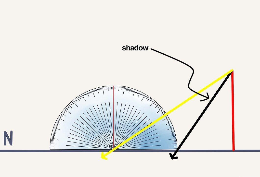
Insert the pole vertically at the southern end of the line. When the shadow of the pole aligns with the direction of the line, this will indicate noon (the best time to make calculations). Place a protractor vertically at the edge of the pole's shadow and measure the angle between the protractor and the line connecting its center to the top of the pole.
- For maximum accuracy, draw a line from the protractor to the top of the pole.
- If you have a laser pointer, use it to accurately determine the angle.
Step 3. Subtract 90 degrees from the measured angle to find the angle between the sun and the point directly above you.
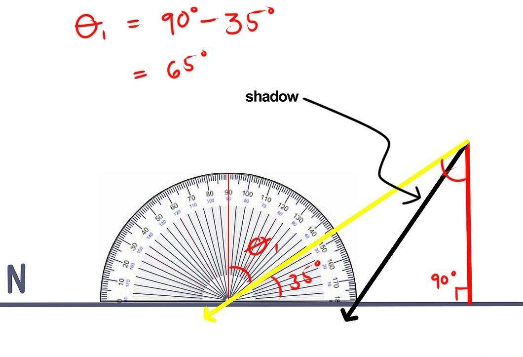
Subtract 90 degrees from the measured angle to determine the zenith angle. If the sun is to the north of you, subtract the angle from 0 degrees.
Step 4. Add the angle of the sun's rays to the zenith angle.
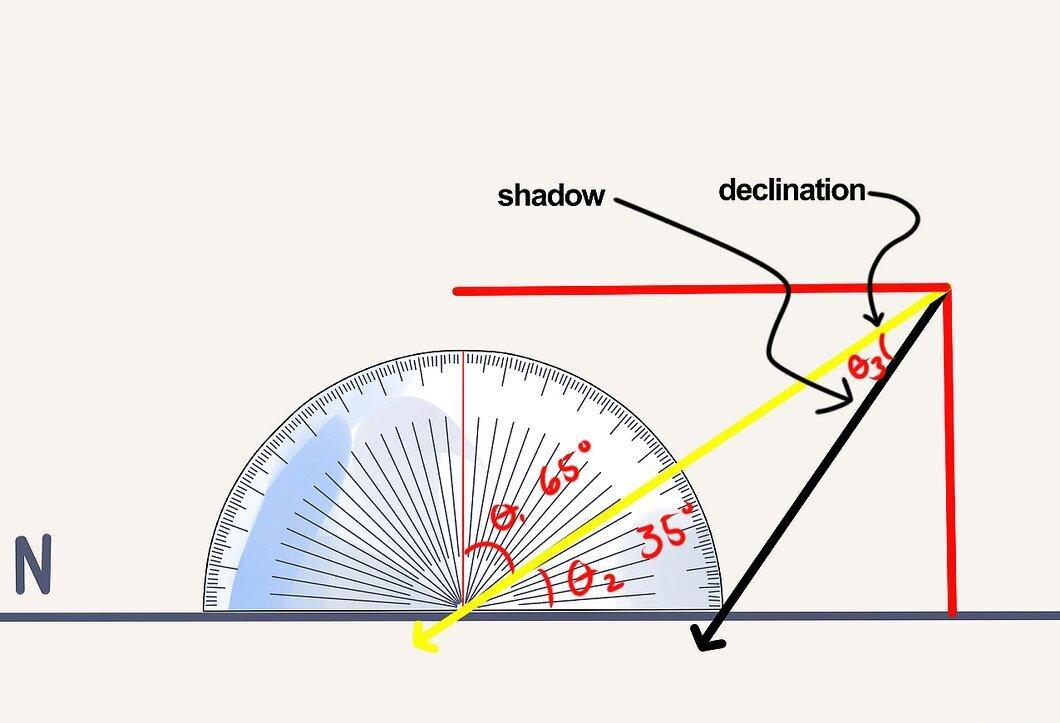
Add the angle of the sun's rays to the zenith angle. This is an approximate value for latitude. Now let's move on to determining longitude.
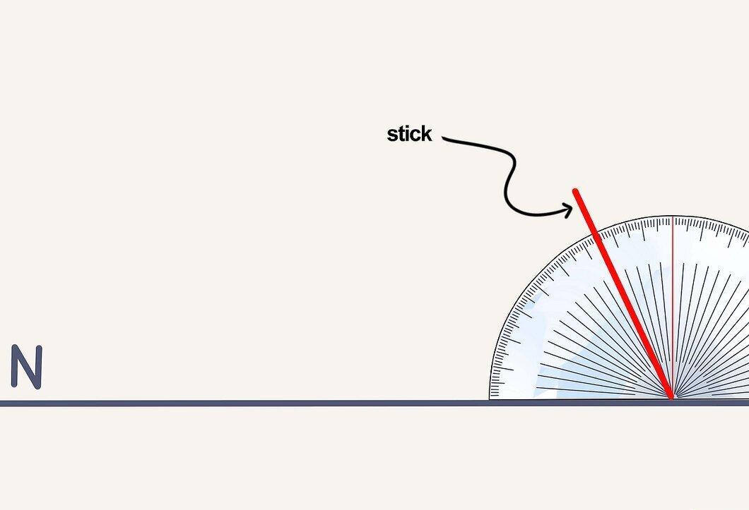
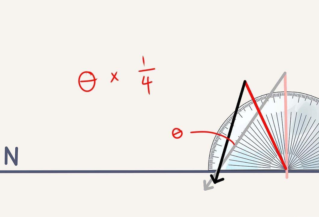
Step 5. Place the protractor under the pole and tilt it so that the angle corresponds to the angle found in step 3.
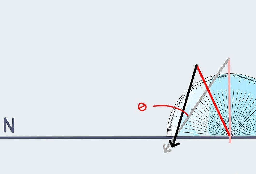
Step 6. Determine the angle between the pole's shadow and west.
Step 7. Multiply the found angle by ¼ to determine the local time in minutes.
Step 8. Determine the Greenwich Mean Time (also known as Universal Time).

Find out the Greenwich Mean Time by visiting http://www.greenwichmeantime.com/
Step 9. Subtract the local time from the universal time and divide the difference by 15.
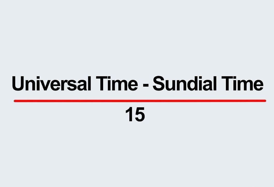
Subtract the local time from the universal time and divide the result by 15 to determine the longitude.