The sextant is a unique navigational instrument that consists of a small telescope, mirrors, a movable handle, and a 60-degree arc known as the limb (one-sixth of a full circle, which is how the instrument got its name). It allows you to determine the position of the sun, moon, or other celestial objects in the sky and calculate your latitude and longitude. Despite its complex appearance, by mastering the principles of how a sextant works and practicing a bit, you can confidently determine your location using it.
How to Determine the Height of an Object Above the Horizon
Step 1. Determine your height above sea level.

Find out how high you are above sea level. If you are using the sextant not on a ship in open water, you'll need to account for height correction. We'll discuss this later, but for now, it's important to know your height.
Step 2. Adjust the sextant to the horizon using the small mirror.
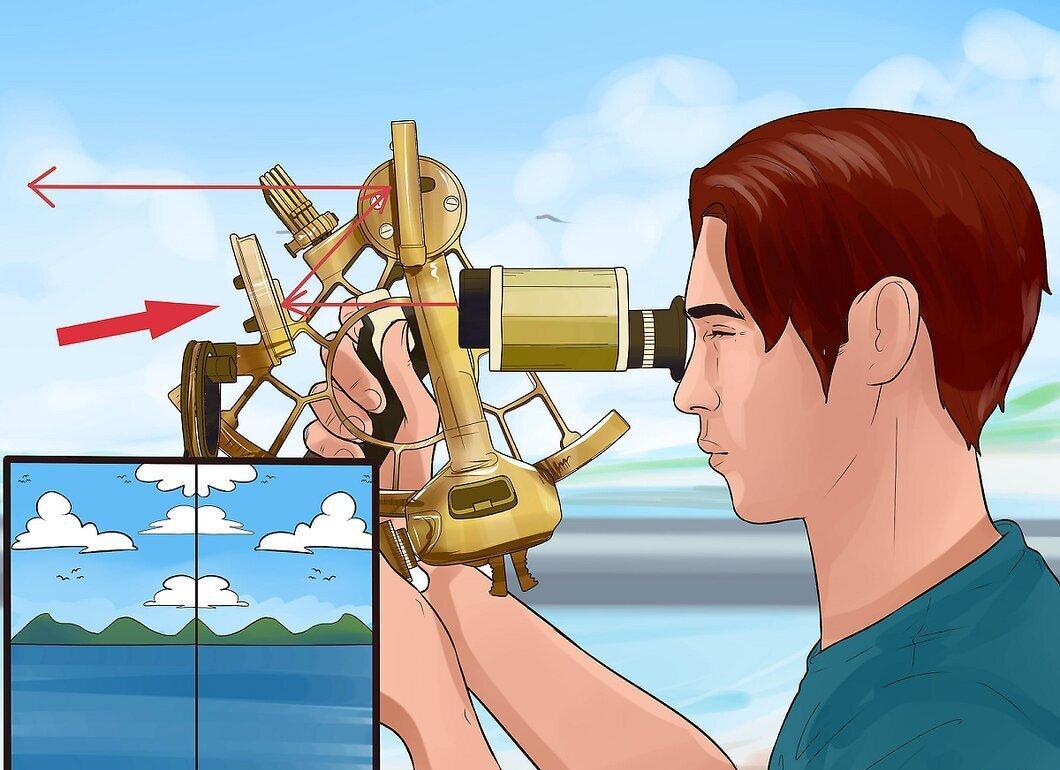
Look through the small mirror to see the horizon. This mirror is semi-transparent, allowing you to see through it while looking in the telescope.
- The horizon line serves as a baseline for determining the angle of elevation of the object you wish to measure.
- If the 0-degree mark on the sextant doesn’t align with the horizon, you'll need to make an adjustment for this discrepancy, known as index error.
Step 3. Rotate the sextant handle until the object appears on the horizon.
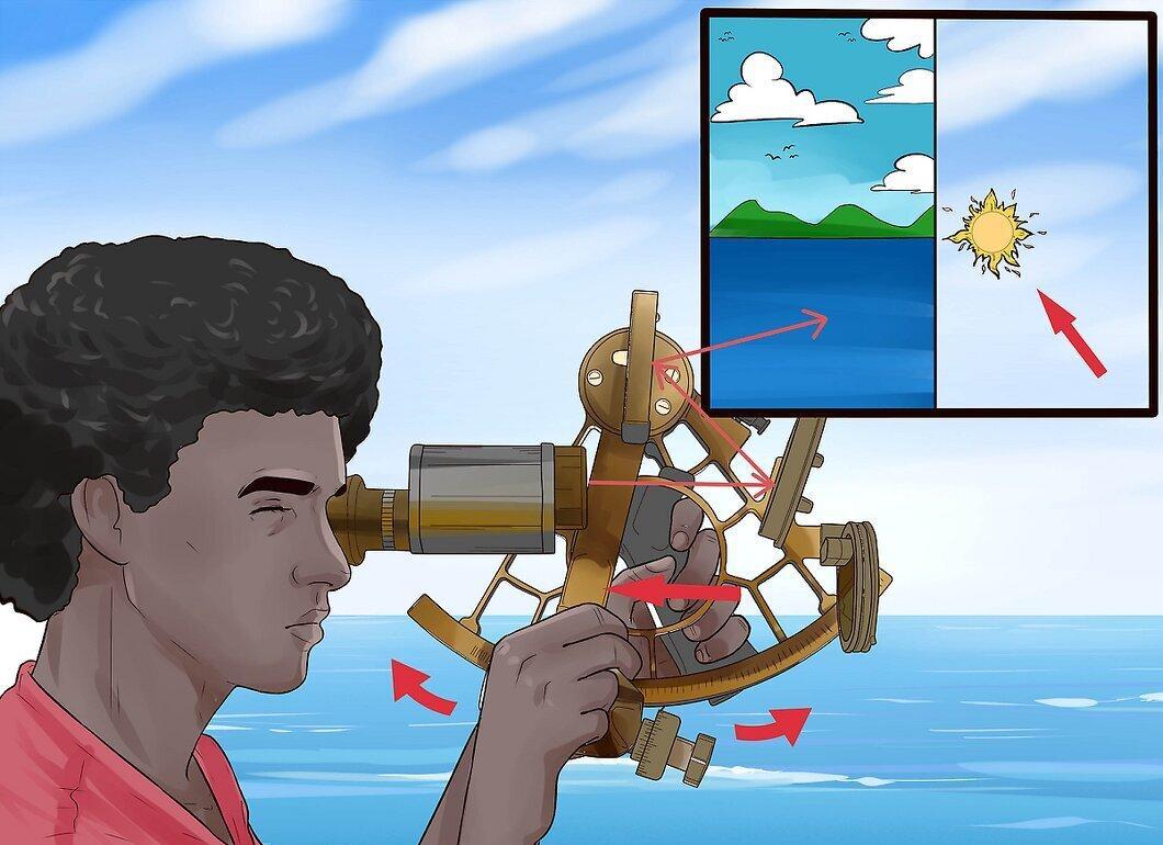
Keep moving the handle until the object you want to measure becomes visible on the horizon. There’s another mirror on the movable handle called the large mirror. As you turn the handle, the disk with the large mirror rotates, reflecting light into the small mirror so you can see the object on the horizon.
- If you are observing the sun, sextants are typically equipped with filters to protect your eyes.
Step 4. Lock the handle in place.
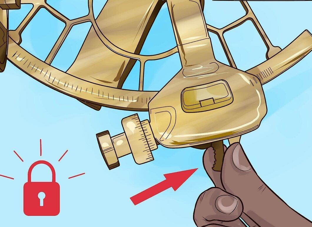
Secure the handle using the flip lock to prevent it from moving.
Step 5. Fine-tune the adjustment by rotating the fine adjustment knob.
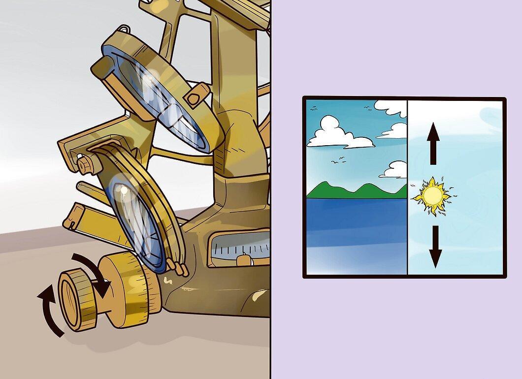
Gradually adjust the handle by turning the fine adjustment knob until the object is precisely level with the horizon. Do this carefully, rocking the sextant side to side.
Step 6. Record the time of observation.
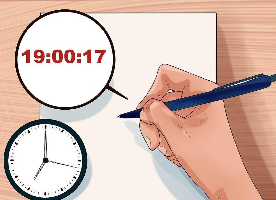
Write down the time in hours, minutes, and seconds, starting with seconds to avoid errors. This is particularly important if you are using the sextant for navigation at sea.
Step 7. Record the measured angle.
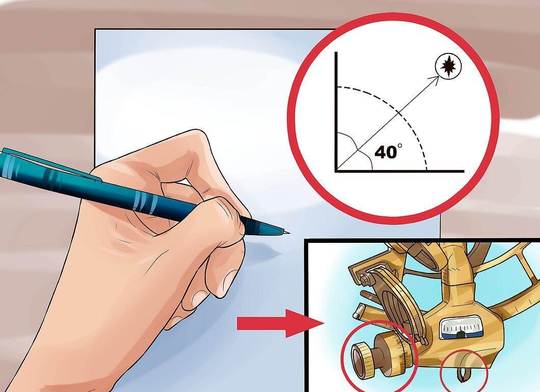
Note the angle of elevation of the object. To read the angle:
- Degrees of altitude can be seen in the center of the alidade (the part of the handle where the clamp and fine adjustment knob are) in the window above the limb. The alidade may have a magnifying glass for ease of reading.
- Count the minutes and seconds using the scale on the fine adjustment knob.
Step 8. Make corrections to the measured angle based on your position and the observed object.
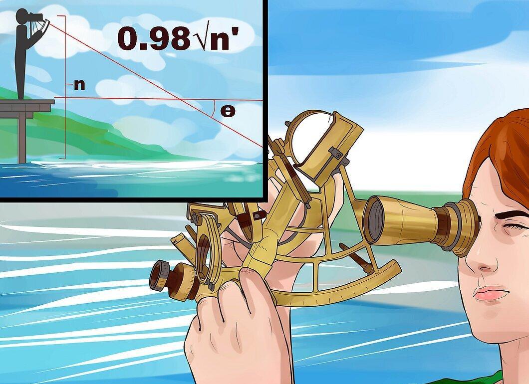
Adjust the angle you measured with the sextant in the following cases: After making all corrections, you will arrive at the true angle of elevation of the object.
- Index Error. This error occurs when the horizon mark does not equal 0 degrees. If it is greater than 0, subtract this value from the measured angle. If less than 0, add it.
- Dip. This correction depends on your height above sea level. Find your height in feet and multiply it by 0.98 to calculate the correction.
- Refraction. Light rays bend as they pass through the atmosphere. Check the correction value in the Nautical Almanac.
- Parallax. If you are observing the sun, moon, or a planet, you will need to apply a parallax correction, which can also be found in the Nautical Almanac.
- Angular Radius. When observing an object with a noticeable diameter (like the sun or moon), you need to know the apparent distance from the edge to the center; the correction value is also in the Nautical Almanac.
How to Determine Latitude Using a Sextant During the Day
Step 1. Determine the angle of elevation of the sun at its highest point.
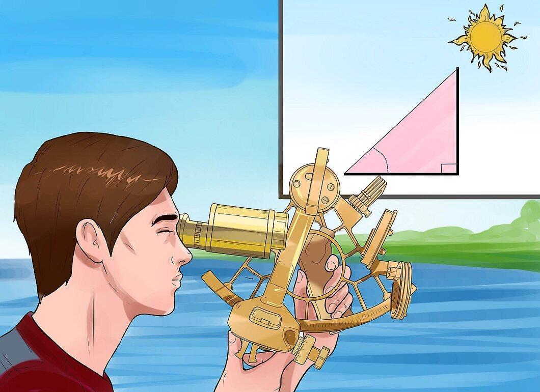
Remember the angle of elevation of the sun at its highest point, which occurs at noon local time.
- Follow the instructions from the first part of our guide.
Step 2. Find the latitude where the sun is directly overhead on the day of observation.
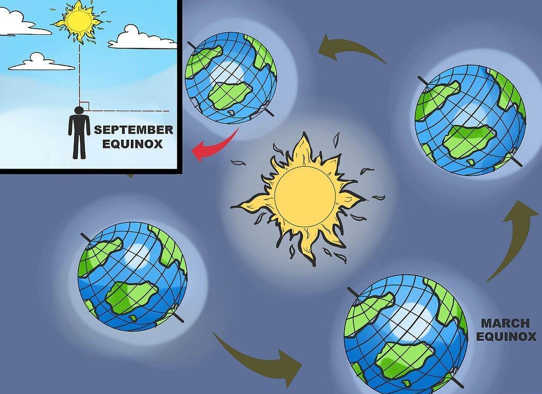
Use reference tables to find the latitude where the sun is directly overhead on the day of observation. At the equator (0 degrees latitude), the sun will be directly overhead during the spring and autumn equinoxes.
- After the spring equinox, the latitude where the sun is at zenith moves north until the summer solstice, then returns back to the equator at the autumn equinox. During the summer solstice, the sun is at the Tropic of Cancer (23.5 degrees north latitude).
- After the autumn equinox, the sun again moves south until the winter solstice. During the winter solstice, it is at the Tropic of Capricorn (23.5 degrees south latitude).
- If you are north of the Tropic of Cancer, the sun will always be to the south at its highest point. If south of the Tropic of Capricorn, it will be to the north. If between the tropics, depending on the time of year, the sun may be either to the south or north.
Step 3. Calculate the difference between the angle of elevation of the sun and zenith (90 degrees).
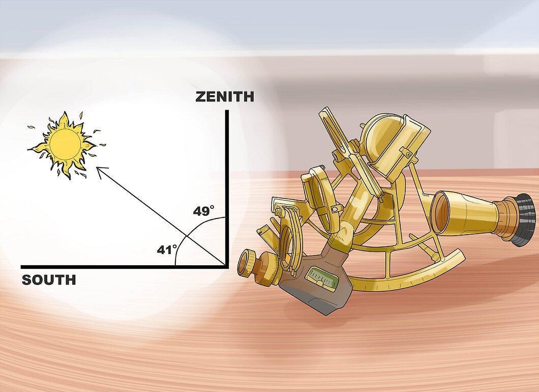
Find the difference between the angle of elevation of the sun and 90 degrees. For example, if your angle is 49 degrees, subtract 49 from 90 to get 41.
- On equinox days, this difference will be your latitude. If it’s another day, more calculations will be required.
- If the latitude where the sun is at zenith is northern and the sun is at its highest point south of you, add that latitude to the calculated angle to determine your latitude. For example, if the sun is at 20 degrees north latitude and you saw it at an angle of 49 degrees, your latitude will be 61 degrees (90 – 49 + 20).
- If the latitude is southern and the sun is at its highest point south of you, subtract it from the calculated angle. For example, if the sun is at 20 degrees south latitude and you saw it at an angle of 49 degrees, your latitude will be 21 degrees north latitude (90 – 49 – 20).
Determining Latitude Using a Sextant at Night
Step 1. Locate the North Star.
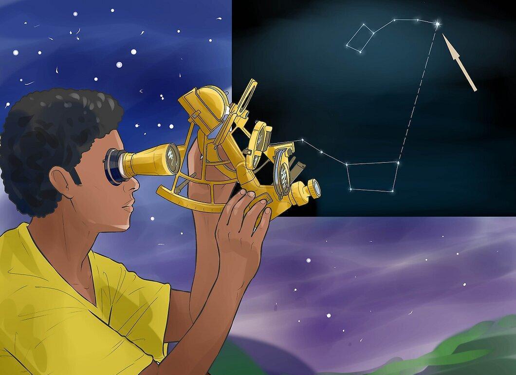
Look for the North Star, the brightest star in the constellation Ursa Minor. It is located at the end of the handle of the Little Dipper. If you have trouble finding it, here are two methods:
- Draw a line connecting the two stars at the edge of the Big Dipper’s scoop toward the open end. These stars will point you to the North Star.
- Aim your gaze from the Great Square of Pegasus toward the constellation Cassiopeia, which looks like an “M” or “W” depending on its position. This is an alternative method for finding the North Star if the Big Dipper is hidden below the horizon.
Step 2. Measure the height of the North Star above the horizon using the sextant.
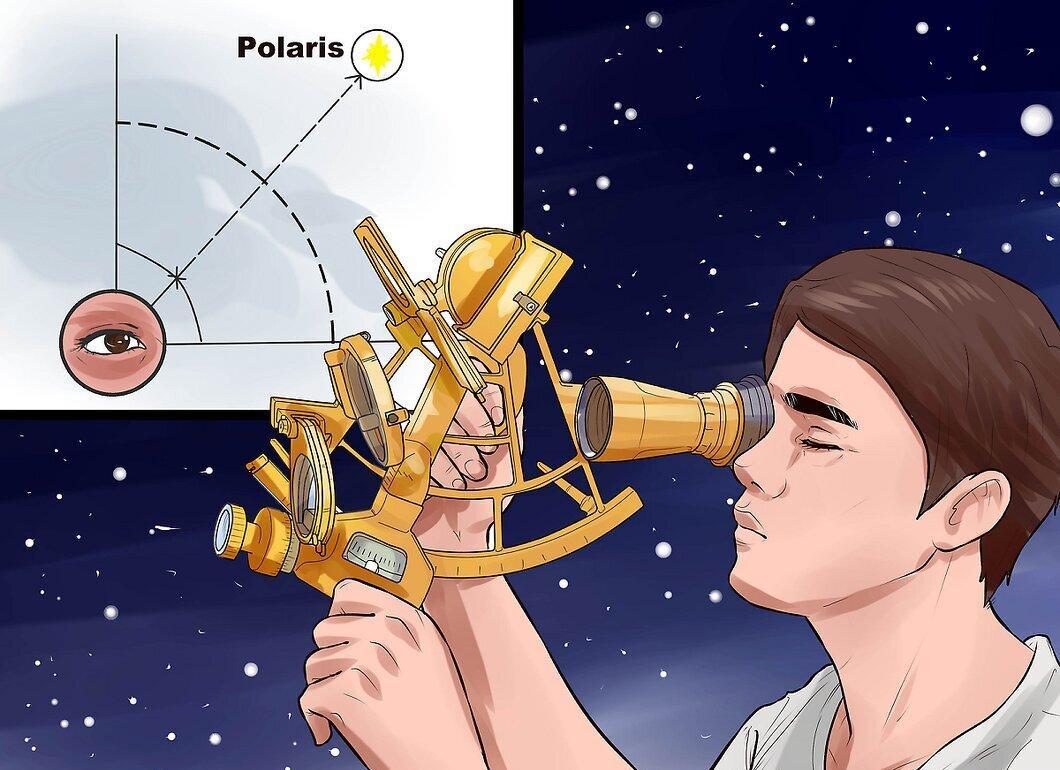
Use the sextant to determine the height of the North Star above the horizon. Follow the instructions from the first part of the article. The angle of elevation of the North Star will equal your latitude.
- This method is valid only in the Northern Hemisphere, as the North Star is not visible south of the equator.