Have you ever spotted Google Street View cars driving through your neighborhood? They're equipped with a large spherical camera that captures a continuous stream of 360° panoramic photos. These images can be viewed on Google Maps on your computer or mobile device.
Using a Computer
Step 1. Open Google Maps.
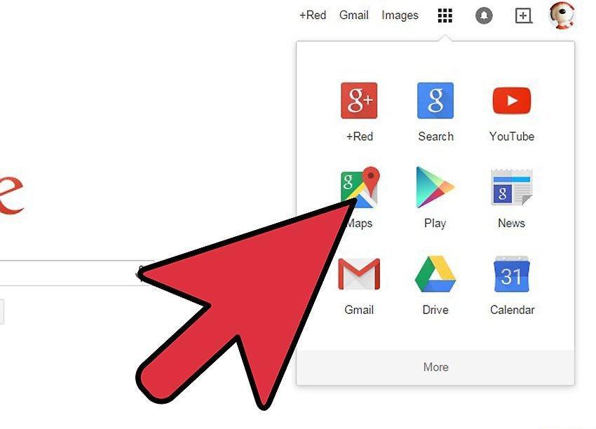
Open Google Maps. Street View is one of the features of Google Maps. Google cars equipped with special cameras roam the road networks of various countries, taking 360° panoramic photos to aid navigation and orientation. Google Maps allows you to view any area where Street View is available.
- You can also use the Street View feature in Google Earth.
Step 2. Find the area you want to see.
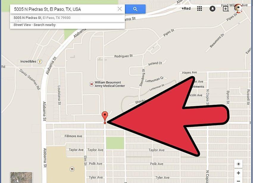
Find the area you want to see. You can either search for a location or move around the map using your mouse. When searching for something on the map, a marker is usually placed on the location.
Step 3. Activate Street View.
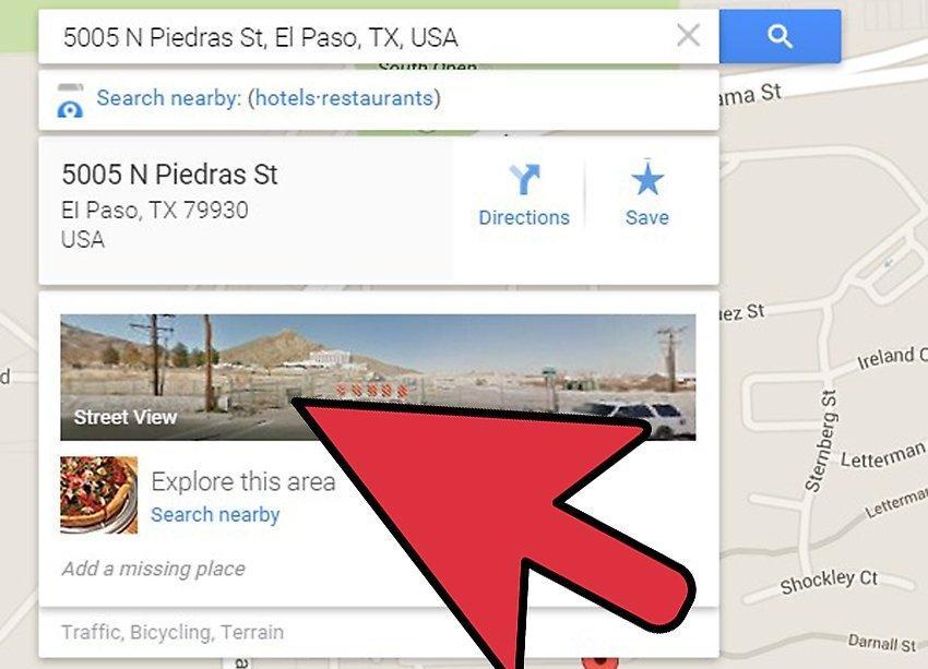
Activate Street View. If you've found the area you want to explore, you can enable Street View. Depending on how you found the location and the version of Google Maps you're using, there are different ways to open Street View.
- Street View for search results. If you searched for an address or specific location and a marker appears on the map, you can open Street View for that location by clicking on the photo in the info window that appears when you select the marker on the map.
- Drag the "yellow man." Click and hold the yellow man icon to drag it. Streets where Street View is available will be highlighted. Streets with Street View will have a blue line down the middle. Buildings you can view inside will be marked with a yellow circle. Scenic spots will be marked with a blue circle. If you're using the new version of Google Maps, clicking on the yellow man will enable the Street View layer on the map.
- Use the "Explore" panel. If you're using the new version of Google Maps, you can tap the arrow icon in the bottom right corner to open the Explore panel. This will show important places and landmarks near your current location on the map. Clicking on any photo will redirect you to Street View for that location.
- Zoom in. Zooming in will automatically switch to Street View mode if it's available for that area.
Step 4. Look around.
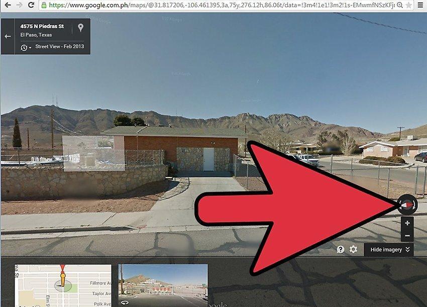
Look around. While in Street View mode, you can look around by clicking and dragging the image with your mouse. The view generally moves in the opposite direction of your mouse movement; for example, to look left, you need to click and hold while moving your mouse to the right.
- You can also use the buttons around the compass to look around. They are located in the upper left corner of the old map version or in the bottom right corner of the new version.
Step 5. Navigate the map.
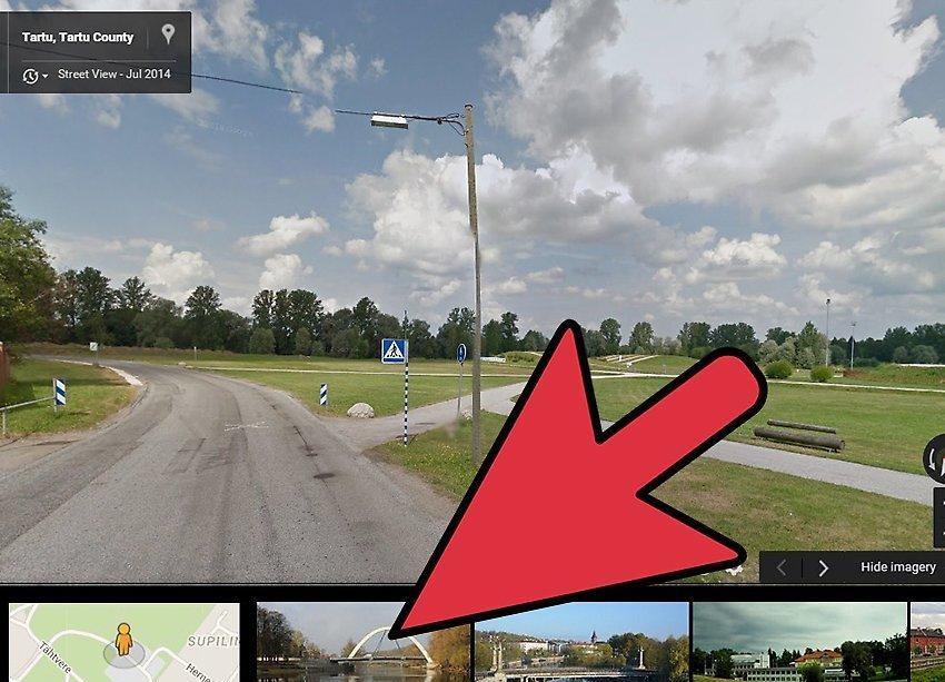
Navigate the map. The true beauty of using Street View lies in your ability to fully orient yourself. Click anywhere on the image, and Street View will attempt to move you to the nearest location to that point. Use this to explore the surroundings, take a virtual trip, or find landmarks in case you plan to visit the place in person later.
- While in Street View, you'll see arrows on the streets. Clicking on an arrow will move you down the street a short distance in the indicated direction.[1] X Source
Using a Mobile Device
Step 1. Open the Google Maps app.

Open the Google Maps app. If you're on the go, Street View is a great way to help you find what you're looking for. Use it to see your destination before heading there, so you know what to look for on the road, or use Street View to find a business or place in an unfamiliar area.
- You can use Street View in any version of Google Maps on any mobile device, as long as you have an internet connection.
Step 2. Place a marker.
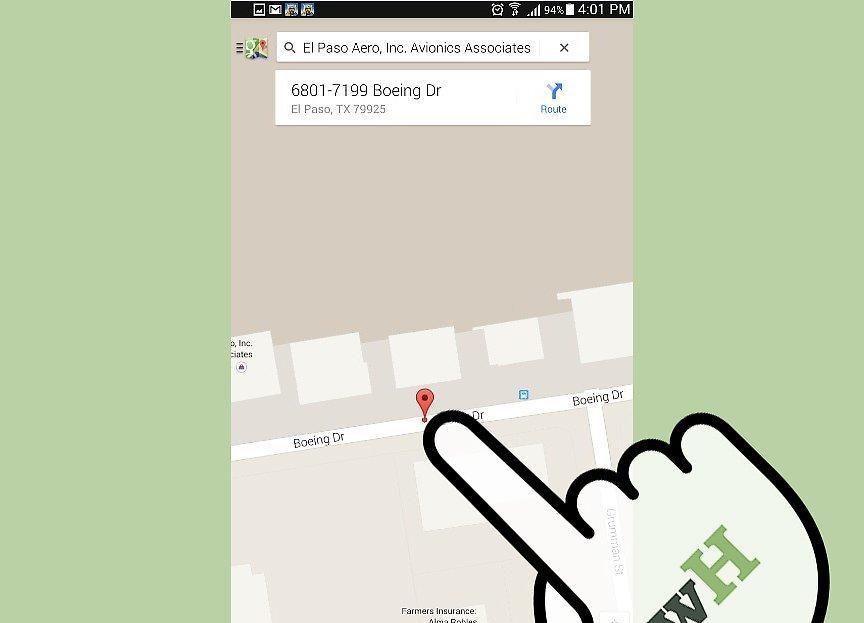
Place a marker. To open Street View, you need to have a marker on the map. You can place a marker during the location search by tapping on a business marker on the map or simply by pressing and holding any point on the map with your finger.
Step 3. Swipe up.
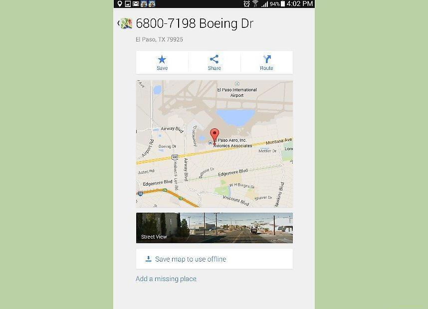
Swipe up. Once the marker is placed, the address and navigation button will be displayed on the panel at the bottom of the map. Swipe up on this panel to open the "Save/Share" screen. If Street View is available for that location, a photo of the area will appear.
- If you select a location not on a road, you won’t be able to open Street View. Try to place the marker as close to the nearest road as possible.
Step 4. Open Street View.
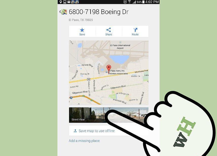
Open Street View. Tap the photo to load Street View mode. The view will change to display a 360° panoramic photo. An internet connection will be required to load the images.
Step 5. Look around.
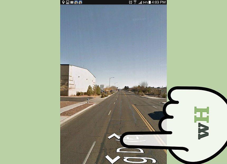
Look around. In Street View mode, you can look around by moving your finger across the screen. The camera view will move in the opposite direction of your finger movement; for example, if you swipe down, the camera will move up. You can zoom in and out by pinching and spreading your fingers on the screen.
- Tap the appropriate icon to examine the image. This can be helpful if you're near the location and want to orient yourself. The icon is located in the lower left corner and looks like two arrows pointing at each other.
Step 6. Navigate the map.
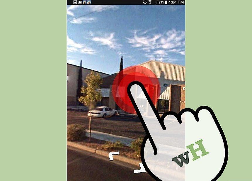
Navigate the map. You can move to any position on the image by double-tapping. Street View will attempt to load a photo of the nearest location. You can also move forward and backward along the streets by clicking on the shown arrows. This is useful for simulating driving, as arrows will appear at intersections for turning.